


ThurGIS
Description of ThurGIS
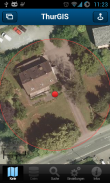
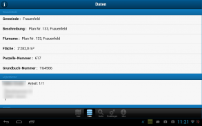
Wer ist der Eigentümer dieser Parzelle? Ist dieses Gebiet Bauland? Finden Sie es heraus!
Willkommen auf der geografischen Informations-Plattform des Kantons Thurgau. ThurGIS ist die Abkürzung für "Thurgauer Geografisches Informations-System" und bietet Ihnen zweidimensionale Ansichten mit georeferenzierten und interaktiven Karten.
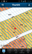
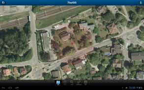
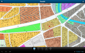
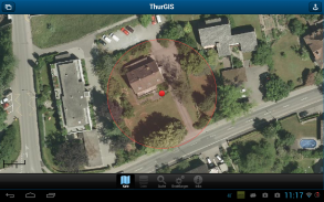
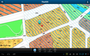
Im ThurGIS finden Sie den Zonenplan in der kantonalen Standarddarstellung, das Orthofoto 2011 und Daten der Amtlichen Vermessung des Kantons Thurgau.
Hinweise:
==========
* Die angebotenen Karten und Daten beschränken sich auf den Kanton Thurgau
* Die Einzelabfragen über den Eigentümer einer Parzelle sind auf 50 pro Stunde beschränkt.
* Für die Nutzung des ThurGIS ist eine mobile Datenverbindung nötig. Dabei können Gebühren anfallen.
Features:
==========
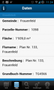
* Abfrage von Eigentümer-Informationen von Parzellen
* Abfrage von Zonenplan-Informationen von Parzellen
* Verschiedene Kartenansichten: Orthofoto, Grundkarte, Hybrid, Zonenplan
* Suche nach Ort, Strasse, Parzelle
* GPS-Lokalisation
* Abfrage über aktuelle GPS-Position oder selbst gewählten Standort
Who is the owner of that parcel? This area is land? Find out!
Welcome to the geographical information platform of the Canton of Thurgau. ThurGIS is the abbreviation for "Thurgau Geographical Information System" and offers you views with two-dimensional geo-referenced and interactive maps.
In ThurGIS you find the zone plan in the cantonal standard representation, the 2011 orthophoto and cadastral survey data in the canton of Thurgau.
Hints:
==========
* The maps and data provided are limited to the canton of Thurgau
* The individual queries about the owner of a parcel are limited to 50 per hour.
* For the use of ThurGIS a mobile data connection is required. It charges may apply.
Features:
==========
* Query information from owners of parcels
* Query zone plan information from plots
* Different map views: orthophoto, base map, hybrid, zone plan
* Search by City, Street, Plot
* GPS localization
* Query on current GPS location or self-chosen location
ThurGIS - Version 2.1.4
(15-05-2018)ThurGIS - APK Information
APK Version: 2.1.4Package: ch.kp.tgmobile


Apps in the same category
You may also like...


